Manual traverse setup
You already have established control or CORS information, but the connection to your project still has to be plotted manually.
Plot, traverse, and label your survey connection from established controls or CORS stations, then export to DXF for final record copy drafting.
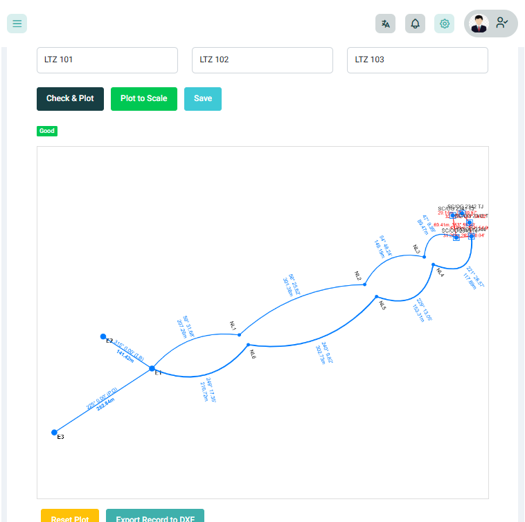
Preparing a record copy often means manually setting up the connection from an established control or CORS station, plotting the traverse, and labelling the survey points before you can continue with your final drafting.
You already have established control or CORS information, but the connection to your project still has to be plotted manually.
Drawing traverse lines and labelling the relevant points manually takes time before you can begin the final record copy.
Instead of rebuilding the initial traverse in AutoCAD, start with a prepared drawing that you can export to DXF and continue working on.
Start from an established control point or CORS station used to connect your survey project.
Use the established control and your project coordinates to create the traverse connection.
Geoflow plots the traverse and handles the initial labelling, giving you a prepared starting point for your record copy.
Export the generated traverse to DXF and continue your final drafting and record copy preparation in AutoCAD.
Connect your project to an established control or CORS station and let Geoflow plot and label the traverse for you. Export the result to DXF and continue your final record copy in AutoCAD.
Go deeper than a feature list — each capability is built for survey operations in Nigeria.
Start your record traverse from an established control point or CORS station instead of rebuilding the connection manually.
Geoflow handles the initial plotting between the established control and your survey project, giving you a prepared traverse to work with.
Relevant survey points and traverse information are labelled as part of the generated output, reducing repetitive drafting work.
Export the generated traverse to DXF and continue the final drafting and record copy preparation in AutoCAD.
Get a prepared traverse from your established control or CORS station instead of setting up the connection manually.
Give your team a faster and more consistent starting point for record copy preparation across projects.
Reduce repetitive plotting and labelling before exporting the traverse for final drafting in AutoCAD.
“We can start with the traverse already plotted and labelled instead of building the connection from scratch.”
See how Geoflow can prepare your traverse from established controls or CORS and get your work ready for final drafting in AutoCAD.