Build Trust in Every Survey You Deliver
From field data to verified plans and branded invoices, Geoflow helps surveyors work faster, prove authenticity, and impress clients.
Request a DemoTrusted by







Your Work Is Precise. Your Workflow Should Be Too
When verification and records live in spreadsheets, inboxes, and paper folders, mistakes cost time, money, and reputation. Geoflow is built to remove that friction.
- Manual processes that don’t scale with your workload
- Lack of verification - hard to prove a plan is authentic
- Poor record keeping across clients, revisions, and handoffs
- Time wasted on admin, follow-ups, and duplicate data entry
From Field Work to Verified Delivery
A simple workflow your entire team can follow without confusion or delays.
-
1
Set up the job
Create the project along with its data so every submission starts from one controlled record.
-
2
Capture work and visualize
Import data, coordinates and every related data, and visualize within the project to get an overview of your work in aerial view
-
3
Verify with QR-linked plans
Tie deliverables to scannable verification so clients and authorities can trust what they receive.
-
4
Deliver and archive
Hand off final packages with traceable history, ready for audits, compliance, and repeat business.
Stop Fake Survey Plans With Instant QR Verification
Attach a unique QR code to every survey plan. Anyone can scan and instantly confirm its authenticity, your credentials, and project details. No more disputes. No more doubt.
- Reduce risk of fake or tampered survey plans
- Give clients and regulators a fast, credible check
- Strengthen trust without extra manual back-and-forth
Security & compliance
Built for trust at every layer
NDPR-ready handling, verified professionals, and encrypted storage — so survey data stays protected end to end.
- NDPR Compliant
-
KYC-Verified Professionals Only
-
Encrypted Cloud Storage
Core Features
What Our Software Offers




Product depth
Tools That Elevate Your Practice
Beyond automation, Geoflow helps you stand out, organize better, present smarter, and earn more client trust.
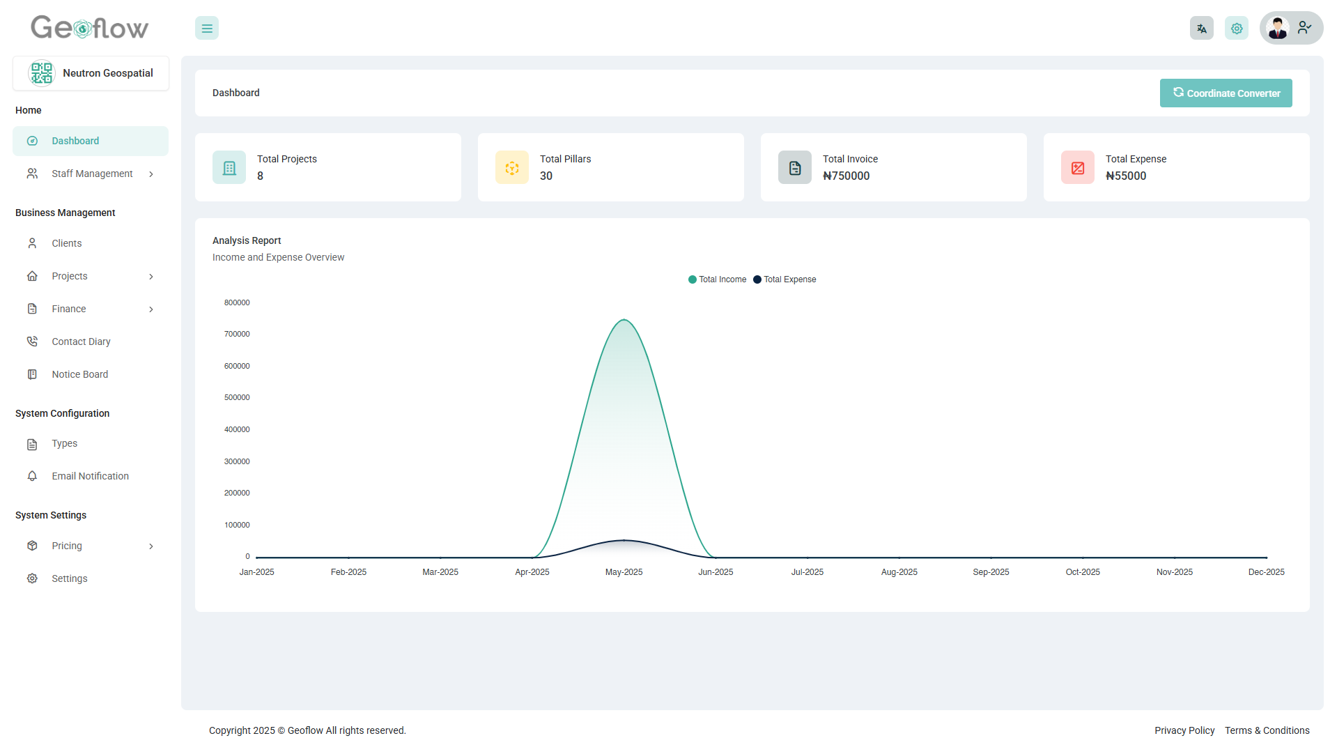
Centralized Project Management
Manage all your surveying projects in one unified workspace. Create, organize, and track project data with ease, from site details to client information, ensuring nothing gets lost or overlooked.
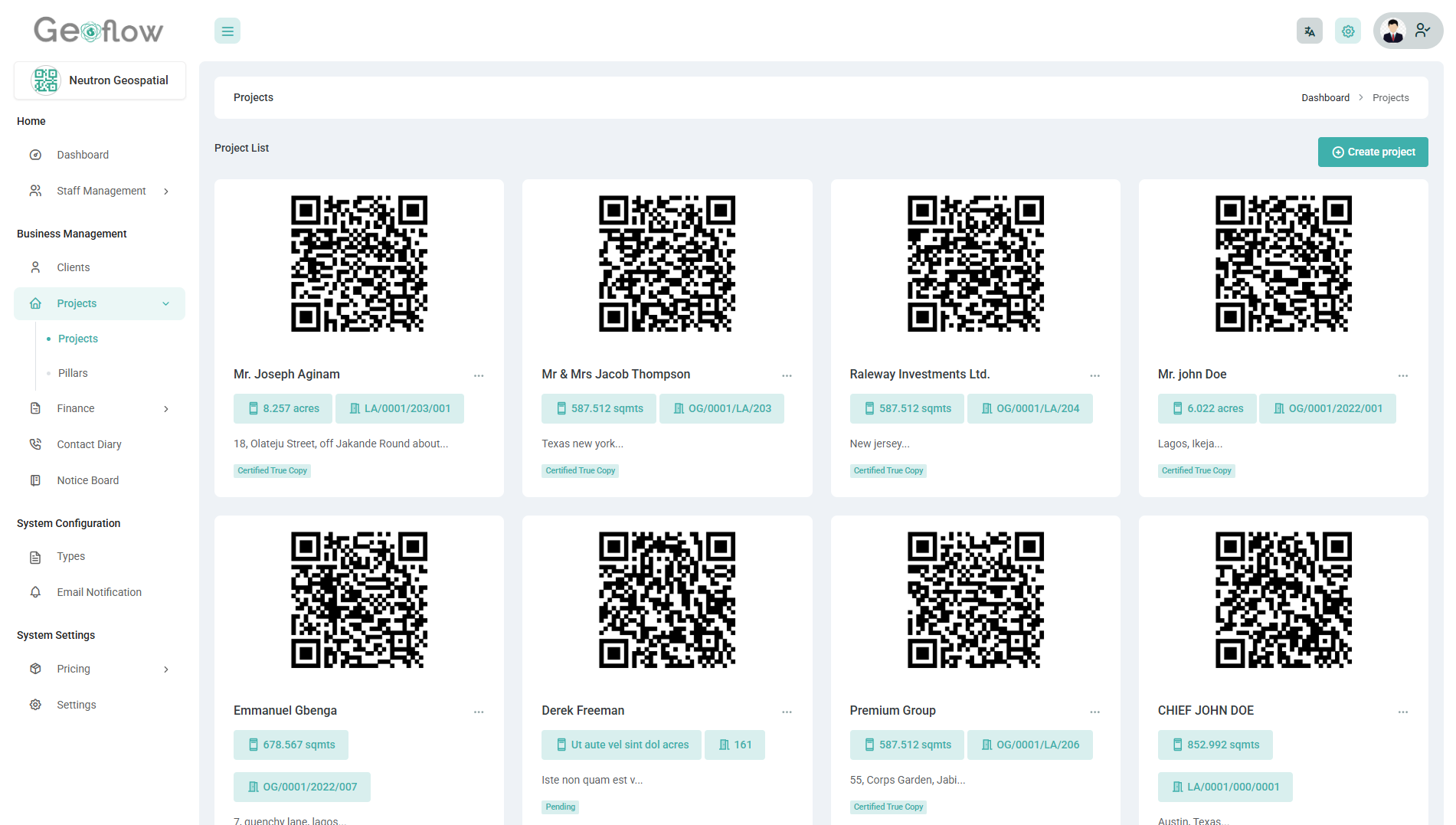
QR Code Plan Verification
Generate secure QR codes for every survey plan, enabling instant verification. Clients and stakeholders can scan to view project details, boosting trust, transparency, and authenticity.
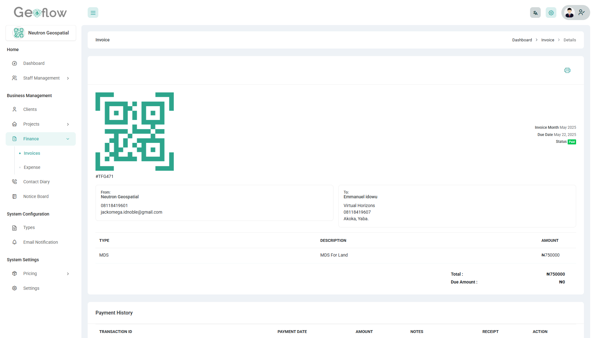
Custom Invoice & Financial Tracking
Generate professional invoices tailored to your brand and track payments effortlessly. Stay on top of your finances with clear visibility into revenue and expenses.
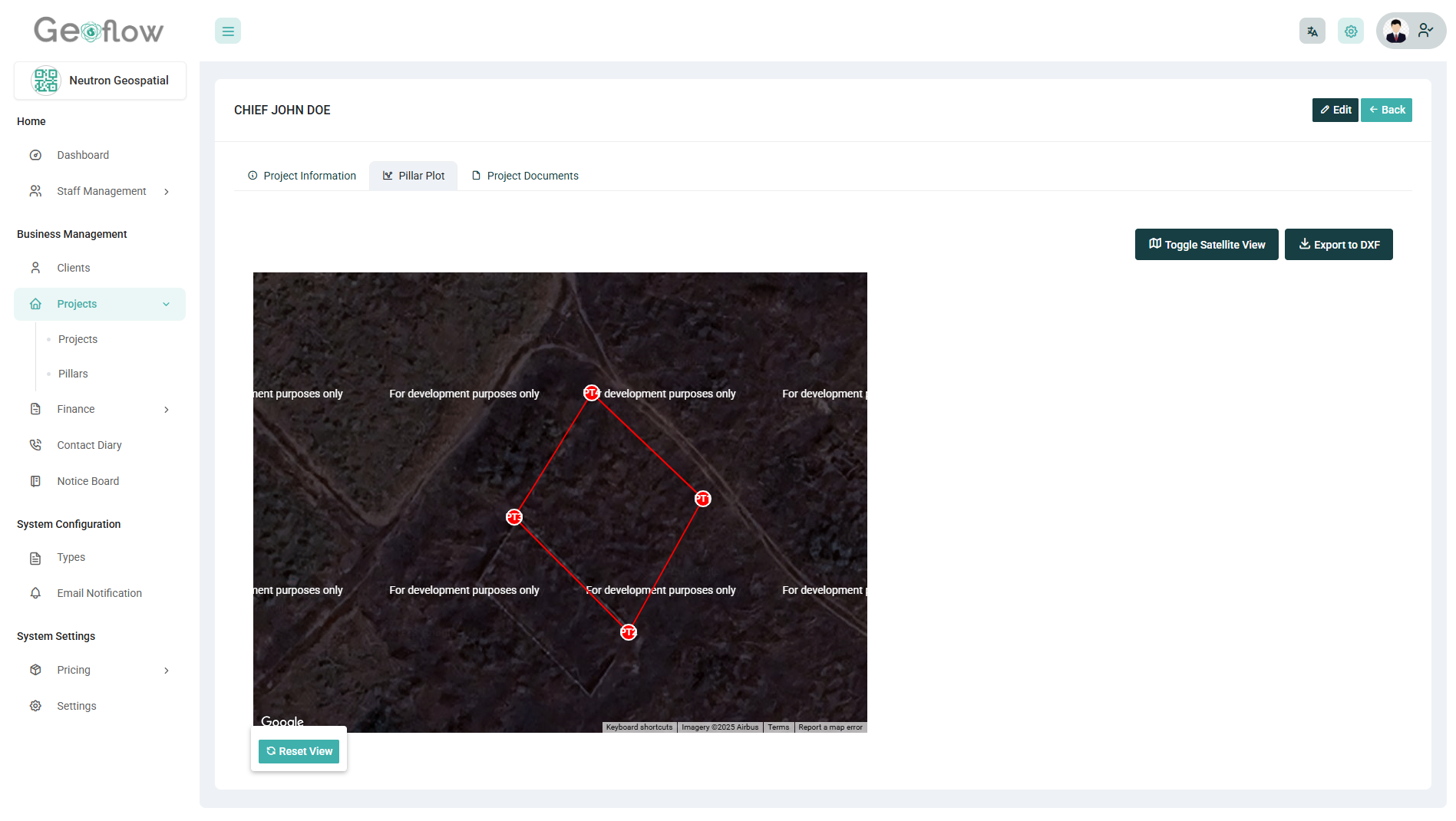
Coordinate Plotting & Boundary Visualization
Plot survey points using angles and distances with precision, and instantly visualize boundaries on an interactive satellite map. Accurately define land parcels, validate layouts, and reduce errors before field execution.
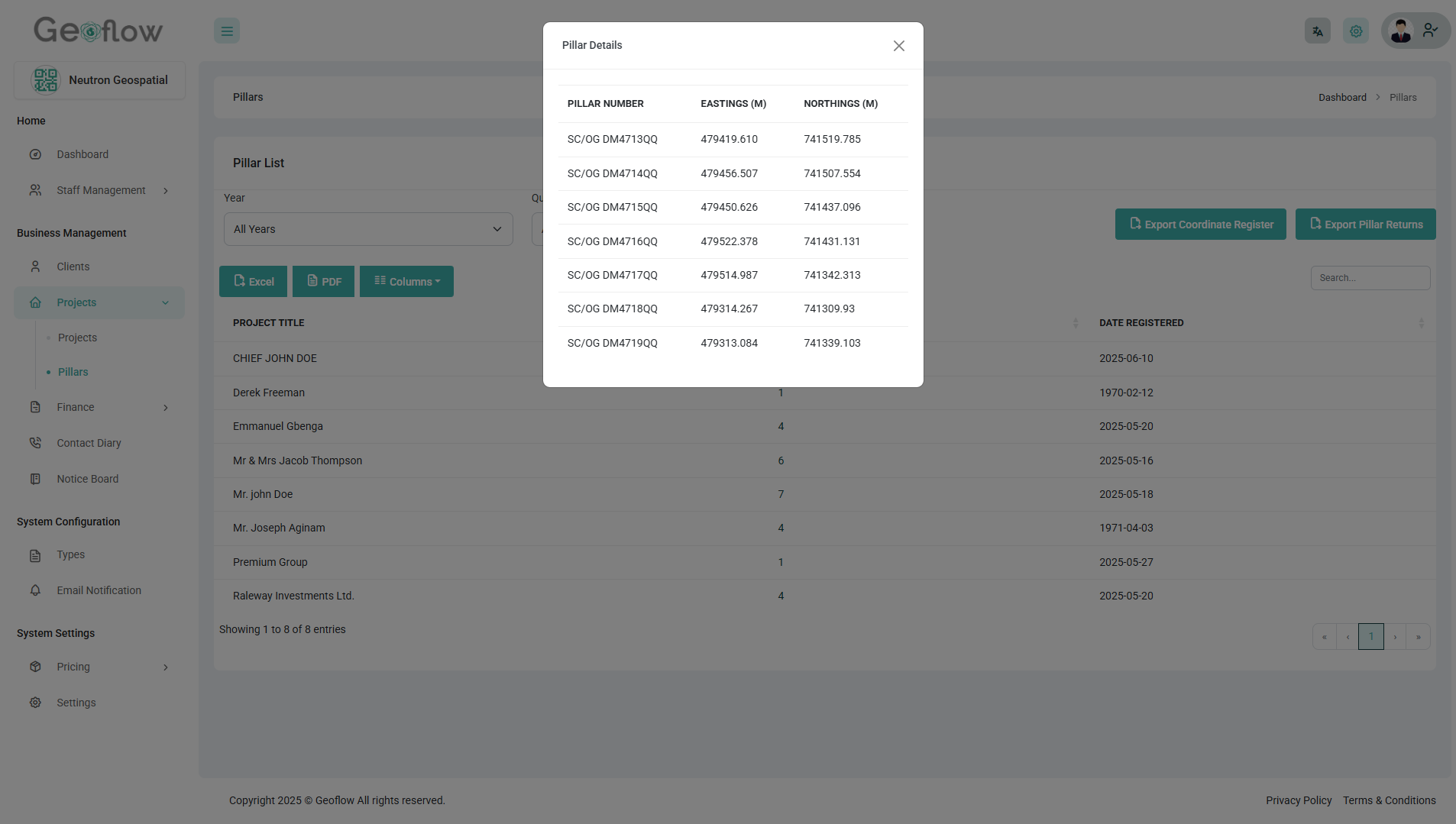
Coordinate Entry & Pillar Return System
Easily register coordinates from the field and use the pillar return system to generate standardized plans with calculated bearings, distances, and annotations, fast, consistent, and export-ready.
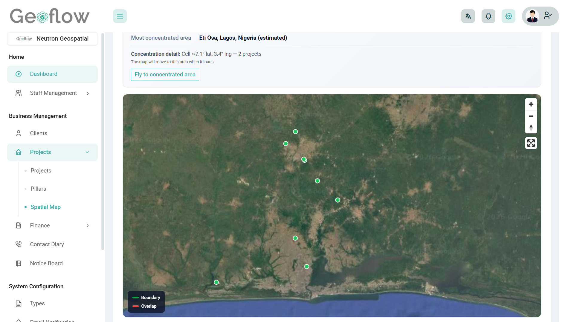
Satellite-Based Project Visualization
View all your projects on an interactive satellite map. Instantly identify project locations, detect overlaps, and gain spatial insights that improve planning accuracy and decision-making.
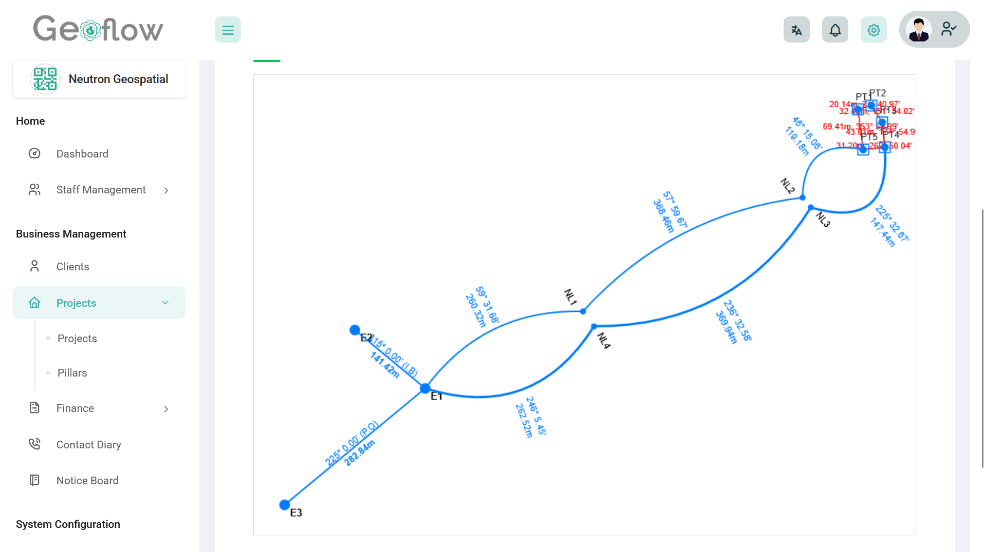
Record Copy Traverse Generation
Generate record copy traverse to and from referenced control points at the click of a button, export to dxf and fix on your personal template as needed
Who it's for
Built for everyone who touches the survey lifecycle
Whether you sign the plan, run the firm, or collect the data, Geoflow keeps the thread unbroken.
Licensed surveyors
Own delivery quality, client trust, and sign-off on every job.
Survey firms
Standardize how teams submit, review, and release work across projects.
Field technicians
Clear assignments and updates so the office and crew stay aligned.
Geospatial companies
Keep spatial deliverables organized with verification-friendly workflows.
Frequently Asked Questions (FAQ)
Still have questions? Here are some quick answers to help you understand how GeoFlow works and why it’s the right tool for your surveying business.
Still have questions?
For assistance, visit our Contact page or email info@trygeoflow.com.
Browse more answers on our FAQ page, or learn how we verify surveyors and protect project data on Trust & Security.
Ready to work smarter with Geoflow?
Book a demo or talk to our team about your workflow.